
How AI is helping to automate coastal and inland infrastructure mapping
|
Connected Services BC is bringing together people, resources and technology to improve collaboration, reduce duplication and support innovation across government. We’re partnering across government to pilot using artificial intelligence (AI) to improve both service delivery and the employee work experience.
We are currently focused on evaluating workflow patterns where AI technology can be most impactful, including intelligent automation, application modernization, information search and retrieval and information analysis and synthesis.
The work of the Ministry of Water, Land and Resource Stewardship is a great example of using AI for information analysis and synthesis.
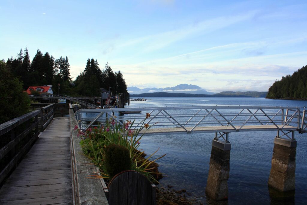
B.C.’s coastlines and inland waterways are dotted with thousands of marine docks. Docks are critical infrastructure for local communities, recreational boat owners and B.C. industry. Gathering a full inventory of these docks would benefit a wide range of interested parties.
Traditionally, identifying and cataloguing docks requires a painstaking manual review of aerial imagery and field surveys. The Sustainable Dock Detection project, developed by GeoBC’s Applied Geomatics Science Team, aims to use new tech to make the process smooth sailing.
By combining free Light Detection and Ranging (lidar) data from the Provincial Lidar Program with machine and deep learning models, the team is building AI tools that can automate dock detection at scale.
Pulling structures from the noise
Lidar uses lasers to measure distances and create precise data models of the earth’s surface. The dock detection process begins with enhancing the lidar data using a normalization method developed in-house. This ensures consistent signal quality across datasets, improving the visibility of dock structures against complex water backgrounds.
A small set of representative docks are manually digitized to provide training data for the system. These shape files serve as the foundation for supervised machine learning.
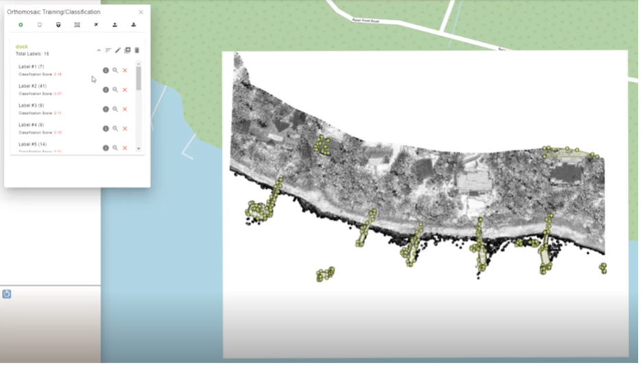
The team also developed a method to boost vertical information along the outlines of docks while still operating within a 2D framework. This creates enhanced dock-specific intensity signatures and produces shapefiles directly from lidar intensity data.
Optimized for efficiency
Having permit conditions available in digital form and using AI to identify reporting requirements offers three key benefits:
- It eliminates the need for inspectors to manually track due dates for permit obligations, reducing administrative burden
- It helps improve how permit conditions are written by flagging unclear or missing reporting triggers
- It makes it easier for mining operations to clearly understand what reports they need to submit and when
This new AI-powered process has freed up time to focus on higher-value work like building strong relationships with partners in permitting, reviewing mining applications and following up on cases of non-compliance.
Neural network training
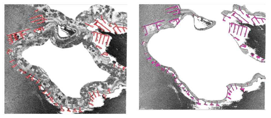
This project uses Detectron2, a state-of-the-art convolutional neural network (CNN) library, to train an AI model for detecting docks.
Individual “neurons” respond to dock-related features such as:
- Surface normals
- Elevation differences
- Wavelet coefficients & gradients
- Enhanced dock outlines from gradient boosting
Instead of following a fixed algorithm, the CNN “learns” correlations between these features, identifying the patterns that indicate docks.
Building on success
The Sustainable Dock Detection project demonstrates how open provincial lidar data, in-house geospatial innovation, and AI can be combined to tackle the important unmet challenge of identifying and managing marine docks.
There are still more docks to be identified. But the development of these tools lays the groundwork for a future where large-scale inventories are automated, scalable and fully integrated with parcel information systems:
High automation
The system reduces the need for manual digitization, offering the potential to leave repetitive work to the system while staff can focus on higher value efforts while maintaining human oversight.
Parcel integration
Docks are not currently linked to existing parcel information. This methodology provides a way to link parcel ownership and land information directly to dock structures, supporting stronger land-water planning, stewardship, and the protection of ecosystems and species.
Innovation in lidar use
Applying in-house normalized lidar intensity data and dock-specific 2D gradient enhancement is a novel approach, positioning lidar as a tool for infrastructure detection beyond its traditional terrain and vegetation uses.
Scalability
Once fully deployed, the system can be applied across the entire B.C. coastline and inland waterways (or adapted for other jurisdictions) to support sustainable marine and freshwater infrastructure management. This work represents our experimentation and learning with this type of AI technology with imagery. Technology and learnings that could eventually support the efforts of other teams and program areas with similar challenges and needs – ultimately to improve outcomes for people, communities and ecosystems in B.C.
For resources and more information on the AI dock detection model and the Provincial Lidar Program, visit the ministry’s intranet site (B.C. government employees only).
Read more case studies highlighting the key results achieved when AI and human intelligence work together.